
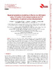
Regional subsidence modelling in Murcia city (SE Spain) using 1-D vertical finite element analysis and 2-D interpolation of ground surface displacements
Por favor, use este identificador para citar o enlazar este ítem:
http://hdl.handle.net/10045/51664


| Título: | Regional subsidence modelling in Murcia city (SE Spain) using 1-D vertical finite element analysis and 2-D interpolation of ground surface displacements |
|---|---|
| Autor/es: | Tessitore, Serena | Fernández-Merodo, José Antonio | Herrera García, Gerardo | Tomás, Roberto | Ramondini, Massimo | Sanabria, Margarita | Duro, Javier | Mulas de la Peña, Joaquín | Calcaterra, Domenico |
| Grupo/s de investigación o GITE: | Ingeniería del Terreno y sus Estructuras (InTerEs) |
| Centro, Departamento o Servicio: | Universidad de Alicante. Departamento de Ingeniería Civil |
| Palabras clave: | Subsidence | DInSAR | Modelling | Murcia city |
| Área/s de conocimiento: | Ingeniería del Terreno |
| Fecha de publicación: | 12-nov-2015 |
| Editor: | Copernicus Publications |
| Cita bibliográfica: | Tessitore, S., Fernández-Merodo, J. A., Herrera, G., Tomás, R., Ramondini, M., Sanabria, M., Duro, J., Mulas, J., and Calcaterra, D.: Regional subsidence modelling in Murcia city (SE Spain) using 1-D vertical finite element analysis and 2-D interpolation of ground surface displacements, Proc. IAHS, 372, 425-429, doi:10.5194/piahs-372-425-2015, 2015 |
| Resumen: | Subsidence is a hazard that may have natural or anthropogenic origin causing important economic losses. The area of Murcia city (SE Spain) has been affected by subsidence due to groundwater overexploitation since the year 1992. The main observed historical piezometric level declines occurred in the periods 1982–1984, 1992–1995 and 2004–2008 and showed a close correlation with the temporal evolution of ground displacements. Since 2008, the pressure recovery in the aquifer has led to an uplift of the ground surface that has been detected by the extensometers. In the present work an elastic hydro-mechanical finite element code has been used to compute the subsidence time series for 24 geotechnical boreholes, prescribing the measured groundwater table evolution. The achieved results have been compared with the displacements estimated through an advanced DInSAR technique and measured by the extensometers. These spatio-temporal comparisons have showed that, in spite of the limited geomechanical data available, the model has turned out to satisfactorily reproduce the subsidence phenomenon affecting Murcia City. The model will allow the prediction of future induced deformations and the consequences of any piezometric level variation in the study area. |
| Patrocinador/es: | This work has been supported by the Spanish Ministry of Economy and Competitiveness and EU FEDER funds under projects ESP2013-47780-C2-2-R and TEC2011-28201-C02-02 and by the project 15224/PI/10 from the Regional Agency of Science and Technology in Murcia. The European Space Agency (ESA) Terrafirma project funded all the SAR data processing with the SPN technique. |
| URI: | http://hdl.handle.net/10045/51664 |
| ISSN: | 2199-899X |
| DOI: | 10.5194/piahs-372-425-2015 |
| Idioma: | eng |
| Tipo: | info:eu-repo/semantics/article |
| Derechos: | Published by Copernicus Publications on behalf of the International Association of Hydrological Sciences. © Author(s) 2015. CC Attribution 3.0 License |
| Revisión científica: | si |
| Versión del editor: | http://dx.doi.org/10.5194/piahs-372-425-2015 |
| Aparece en las colecciones: | INV - INTERES - Artículos de Revistas |
Archivos en este ítem:
| Archivo | Descripción | Tamaño | Formato | |
|---|---|---|---|---|
 2015_Tessitore_etal_ProcIAHS.pdf 2015_Tessitore_etal_ProcIAHS.pdf | 5,45 MB | Adobe PDF | Abrir Vista previa | |
 Ver citas en Google Académico
Este ítem está licenciado bajo Licencia Creative Commons
